The 6th Bomb Group: Tinian Island - Map
Tinian Island

Someone visiting Tinian today would have a hard time imagining that, for 9 months, starting in December 1944, Tinian was the largest and busiest airbase in the world.
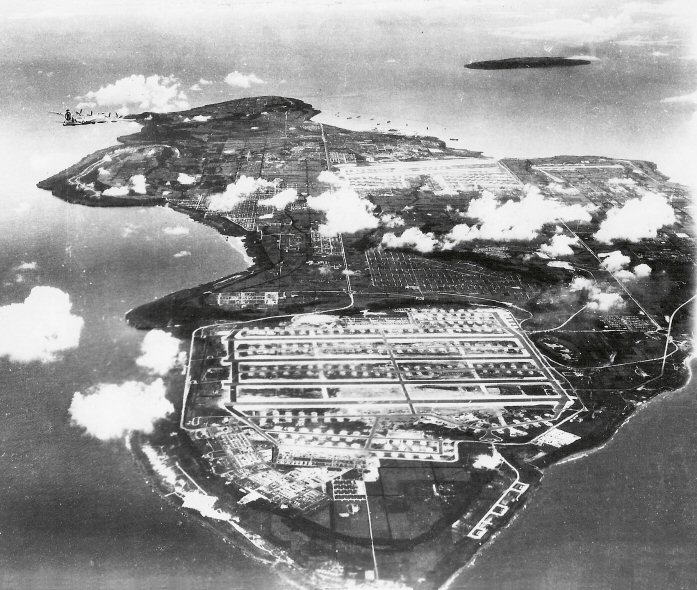
(Click on the picture for more information about that particular area.)

Here is a view of Tinian from the north, facing south. North Field is in the foreground. West Field is to the south, about 2/3 of the way up the picture. The living quarters for the flight crews are in between. "Goat Island" is in the distance.

Index
Background and History
Geography and History of the Island
Topography of the Island
Capture of the Island
Saving Japanese Lives
North Field

Constructing North Field

The Ushi Airfield Area
Japanese Air Administration Building
Japanese Air Operations Building
The Atom Bomb Pits - Then and Now
The Control Tower Area
The Service Area
Southwest Corner
Tinian Island During WWII
WWII Map and Aerial View
Tinian Roads (Then and Now)
Housing Areas - All Groups
Housing Areas - 6th Bomb Group
Housing Areas - Service Groups
Life on the Island ("Meet the Marianas")
Island Wildlife
Tinian Beaches and The Blowhole
Helicopters Over Tinian
Tinian Harbor (Then and Now) and Ships
The October 9 Typhoon
Tinian Island Today
Tinian in Color
Virtual Tinian
View or Download Large Topographic Map of Tinian