|
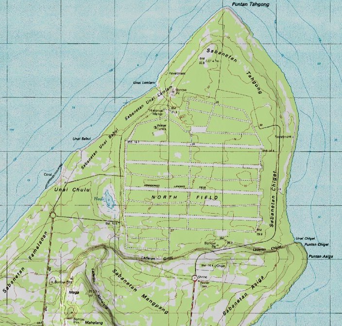
The map above shows the outlines of North Field. The topography of Tinian is a series of plateaus. North Field was built on the lowest plateau on the North End of the island. This plateau is about 100 feet above sea level. The four parallel runways ran roughly facing east and west. The runways were made of asphalt laid over a base of crushed coral. These runways were 8,500 feet long and 500 feet wide (including shoulders). The runways and hardstands are in the center, between the runways. The original Japanese airbase and buildings are in the northwest section. The tower is in the north central section. The service area is in the northeast section. The old Seabee camps in the southwest section were converted to a parking area for the 6th BG. The Seabees moved their camps to the plateau to the south, which they called "Harlem". As the above map shows, the airbase extended south until the steep hills of the plateau prevented further construction. |
|---|
|
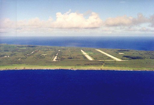
| Here is a view of North Field today, from the east side facing west (presumably, this picture is taken from a commercial airliner operating out of Saipan). Runway Able (to the right) is in the best shape because that is where the atomic bomb exhibits are located. |